


| Evidence of railroad, logging and mining history is everywhere out here. That is one of the great treasures of California. In november 2006 I was approached with an offer to work on new exhibits for the Yosemite National Park visitor center. I am a professional model builder. Naturally I accepted the offer. This was an opportunity to spend one month living in an area rich with these very treasures I speak of. While I would be installing exhibits and models to educate future generations about Yosemite’s stunning natural history I would be searching for inspiration for my own models. |
| A model railroader can never have enough inspiration. This inspiration would come in the form of the stories of men and machines, historic structures, and a landscape that still bears the marks of an industry that once flourished here. It was an industry that managed to conquer one of the mightiest landscapes in California. It is the story of the Yosemite Valley Railway |
| The real story of the Yosemite Valley Railway is much larger than I can cover here. More importantly this story has already been told. Jack Burgess, an acclaimed model railroader himself, wrote the book “Trains to Yosemite” and his book is a must for fan of California railroading. My story is of the remains, the after image, that is burned in time, from the Yosemite Valley Railway. |
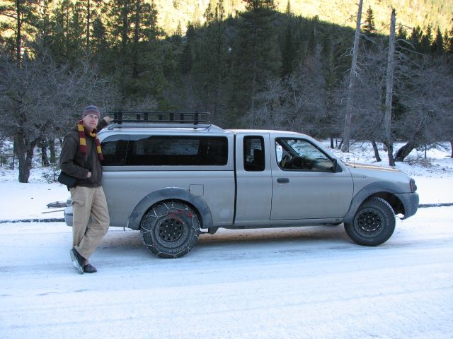
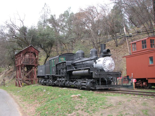
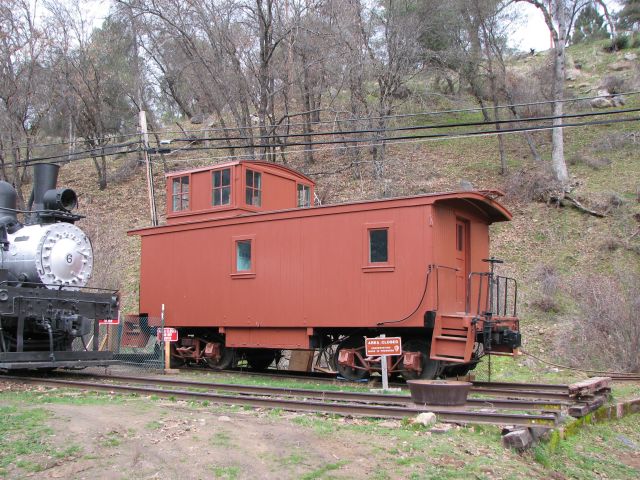
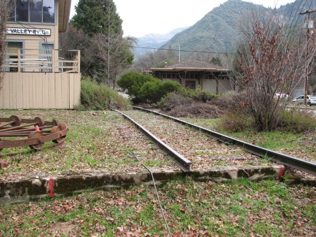
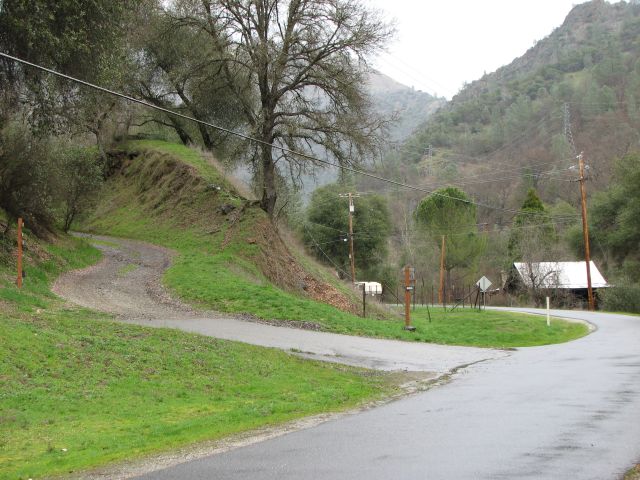
| My adventure began on the morning of February 18, 2007. I was staying at Cedar Lodge for the duration of the project. Cedar lodge is about five miles west of El Portal. El Portal was the terminus of the railroad. I thought I would begin my exploration there. The railroad, and now Highway 140, follows the Merced River through a deep rocky valley. El Portal was the last town before the Western gate to Yosemite park. There is a small preservation effort in El Portal. This standard gauge, 3 truck Shay is on display In El Portal. |
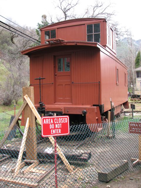
| Also on display is this wood caboose. |
| The caboose also appears to be undergoing active restoration. |
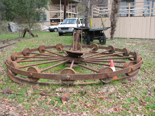
| There was work going on on a wood gallows turntable. Here you can see the concrete bearing foundation in place. |
| A short spur of track ends at the edge of the tuntable pit. |
| All of the metal parts for the turntable were sitting near the pit, like this spider-bearing. |
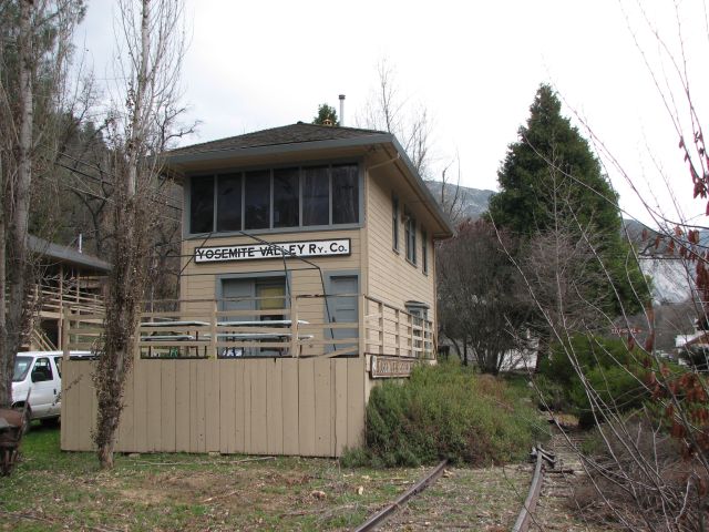
| This switch tower is also preserved. |
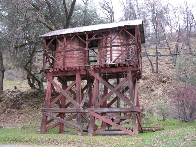
| The double water tower of the Yosemite Valley Railroad is also preserved. This iconic structure is no longer in it's original location, but it is in great condition. |
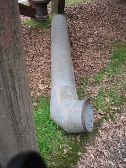
| The spout for the water tower is lying on the ground next to the tower. |
| I knew that somewhere west of El Portal there was the remains of a town called Incline. The aptly named town of Incline had one distinguishing feature: a massive logging incline that shot skyward up the north side of the valley. I decided my best chance of finding the incline was to drive some of the old right of way and look for some of the abandoned structures in the town of Incline. |
| Some light off-roading was required to access the first structure of my visit to the town of Incline. |
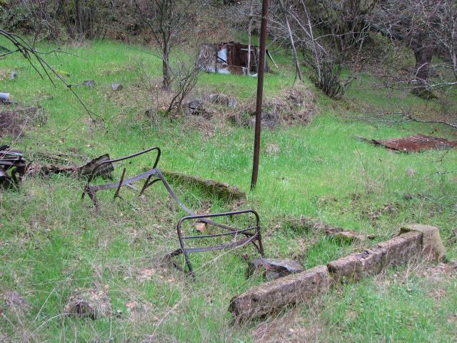
| Old concrete foundations and a rusting bed frame are about all that is left of the town of Incline. There are a handful of private residences further up the hill as well. |
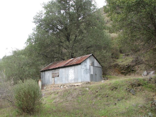
| The only intact building, dating from when the railroad still operated, is this pump house. |
| Armed with Burgess’s book, my camera, and a California road atlas, I was able to positively ID the pump house. From here I could use maps in his book to locate the remains of other structures, and ultimately, the logging incline itself. |
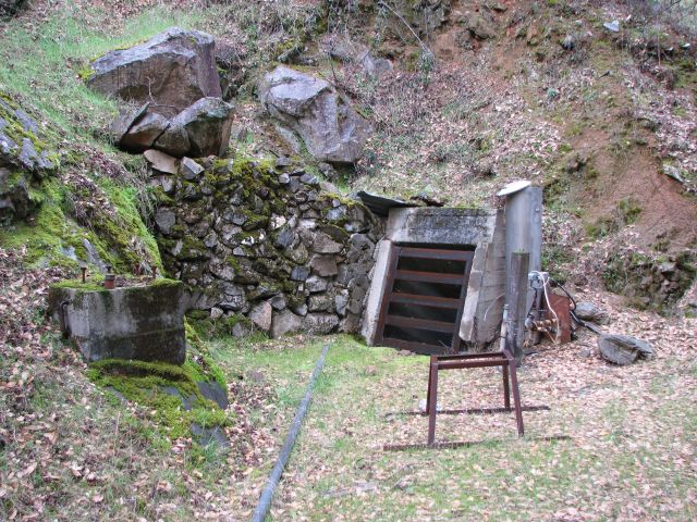
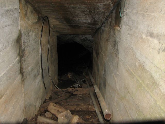
| Near the pump house was this small tunnel going into the side of the mountain. |
| I'm not sure what the tunnel was used for, but I couldn't resist taking a photo peering into the darkness. |
| My maps indicated that if I drove east on the old railroad right of way, which is now Foresta Road, I would find the base of the logging incline. I kept Burgess's book open to a page with a photo of this area, and before I knew it, I was looking at that very spot. What once was rails is now paved roads. The track came down the embankment from the left and merged with a siding connected to the mainline which was located where I was standing. |
| As I continued driving up the old Yosemite Valley Railroad mainline, this concrete foundation caught my attention. I swung around and parked on the North side of the road. This foundation was a base for one of the many pulleys used to manage the wire cables that lowered the loaded railroad cars down the side of the mountain. The railroad cars would then be unloaded. From here, the empty flat cars would be winched back up the incline which reached a staggering 65% grade! |
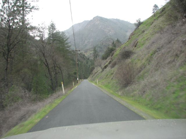
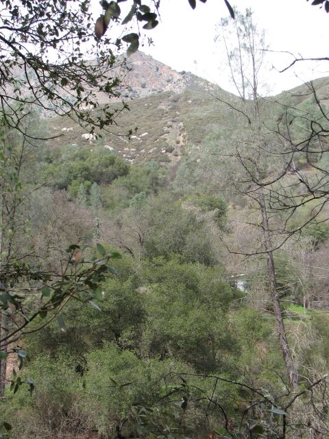
| Once I had located the base of the incline, I knew I would be able to spot the feature from the other side of the Merced River. The former location of the incline would look like a scar in the mountain side. I quickly drove to the nearest bridge and excitedly crossed the river. I drove back west on Highway 140 peering out my passenger side window. The layers of mountain-scape shifted into position and the incline revealed itself (Visible here in the top center of the photograph as the area with less foliage on the mountain.) |
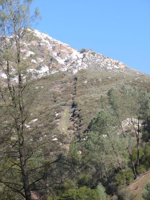
| Like a gash in the mountain, the incline is clearly visible with a dusting of snow. It was here that old log cars carrying thousands of pounds of fresh cut timber were lowered down 1.67 miles and 3000 feet of elevation to the mainline below. |